14,505 ft. That is the peak elevation of Mt. Whitney – the tallest mountain in the lower 48 – and 8,360 ft is the elevation at the trailhead. Between those two points are 22 miles of heaven and hell; bliss and agony. If you have accidently stumbled upon this post while searching for tips on conquering this beast, what follows is unlikely to be helpful. But, I welcome you on my journey.
In 2013 the Lt. had to make that first decision on whether to stay or leave the Corps. Anyone ever heard the EAS song? It used to be on repeat at our house. I knew he wanted out. He had come back different from the 2nd deployment; he seemed to exist in this defeated state of sad. I told you that Lt. was kind. He was the type of guy that would shovel our driveway then walk the block to do two more houses where we had elderly neighbors living; neighbors we had maybe met once. He always looked out for others. I loved that about him.
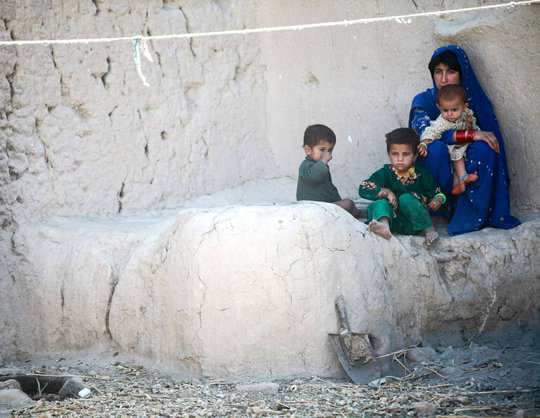
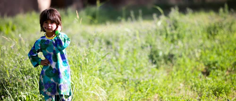
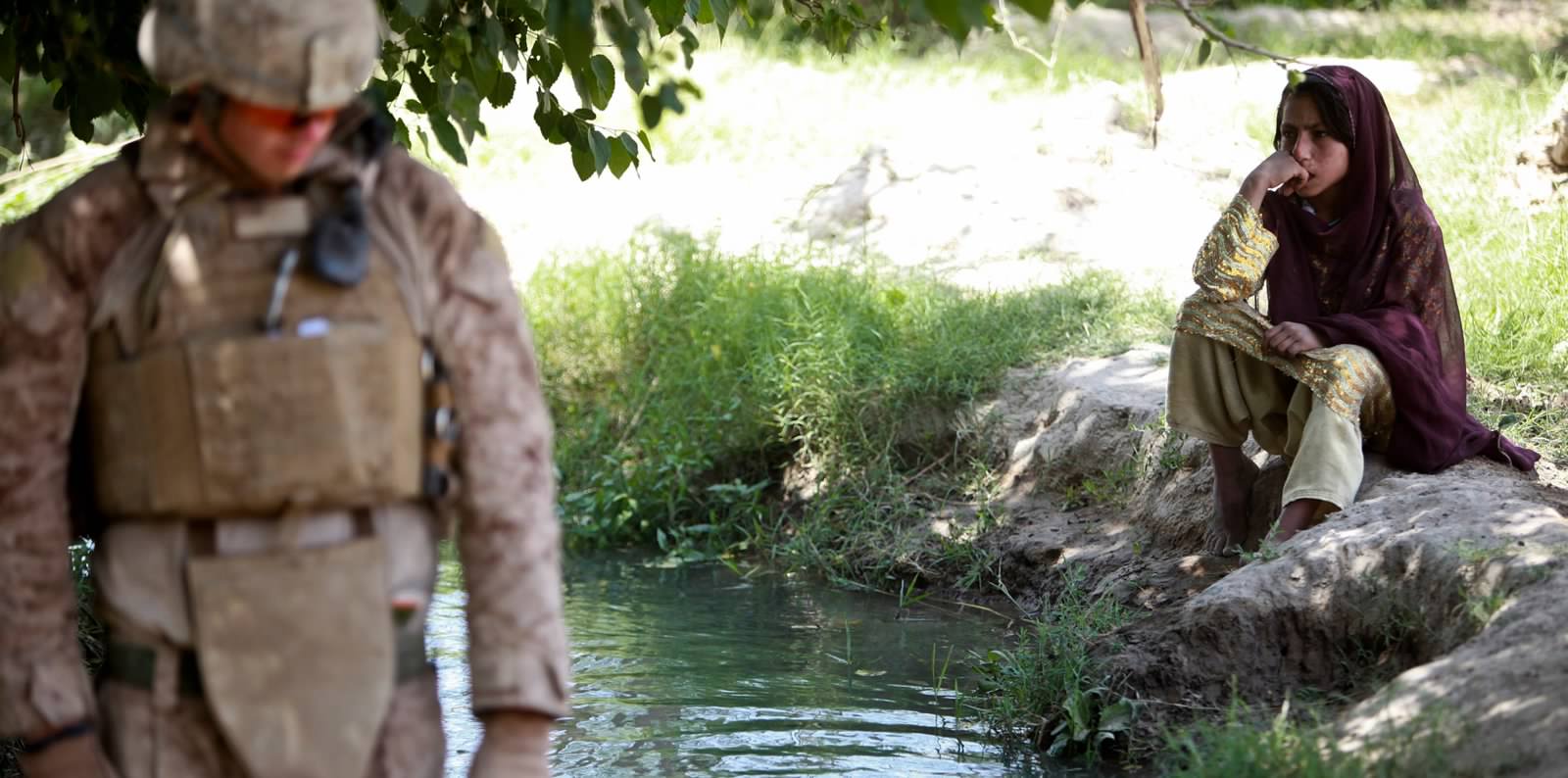
During the second deployment, Lt. spent more time on the road and in the villages. It seemed to me, from the stories he told and the pictures he took, that he was grieving not only for those he served with – those who came back injured (mentally or physically) and those that never came back – but also for the children and families of Afghanistan. People for whom the war was not a 9 month stretch but a constant reality. To top it off, most of the US was so caught up in recovering from the economic crash that they didn’t even seem to notice we were also at war. These are a few of his photos.


BUT. Even with all the baggage he brought back, I knew there was a piece of him that was made for military life. The altruistic aspect of it all spoke to his soul. It is a duty that requires you to offer your whole life (truly, the military comes first. Every. Single. Time.) in service, and potentially sacrifice, for the protection of others you don’t even know. What else could possibly have the same level of meaning? I told him that I thought he should stay in, but that I supported any decision he made. He declined.
We floundered in Cali for a few months but made it work financially. We LOVED our apartment – but just as our lease was coming up for renewal the Lt. was offered a job back in Michigan. The owners of my company had already relocated to TN so they were willing to let me work remotely from anywhere. I thought it was perfect.
We could move back home and be near family. When we got married we had 6 living grandparents between us. We lost 3 and an Aunt in the few years we were away – Lt. only made it to two. Bear, our nephew, was about to turn 4 – he was becoming his own little person. We would be able to see him grow up.
We made the move back to MI in May of 2013, and of course, as soon as we move, my brother, Cornelius, reveals he was able to snag a Mt. Whitney permit. The 3 of us did a lot of outdoor adventuring in California together. So we booked plane tickets back to San Diego less than a month after moving home. June 21st, 2013. We were doing it. This would be our biggest adventure yet.

Fun Fact 1: Hiking Whitney requires a permit that can only be obtained through a lottery system. In 2019 only 34% of applicants received the type of permit they wanted on the days they wanted. The pass I’m telling you that you want is the overnight pass. You’ll carry a heavier load since it will be full-on backpacking, but it allows you to stop and camp at multiple elevations along the trail. Most people end up with a day-pass. That means you have exactly 24 hours to make the 22 mile round trip from portal to summit. Don’t forget your crap bags. You pick them up with your permits – get at least two and don’t be the dirtbag who shits on the actual trail.
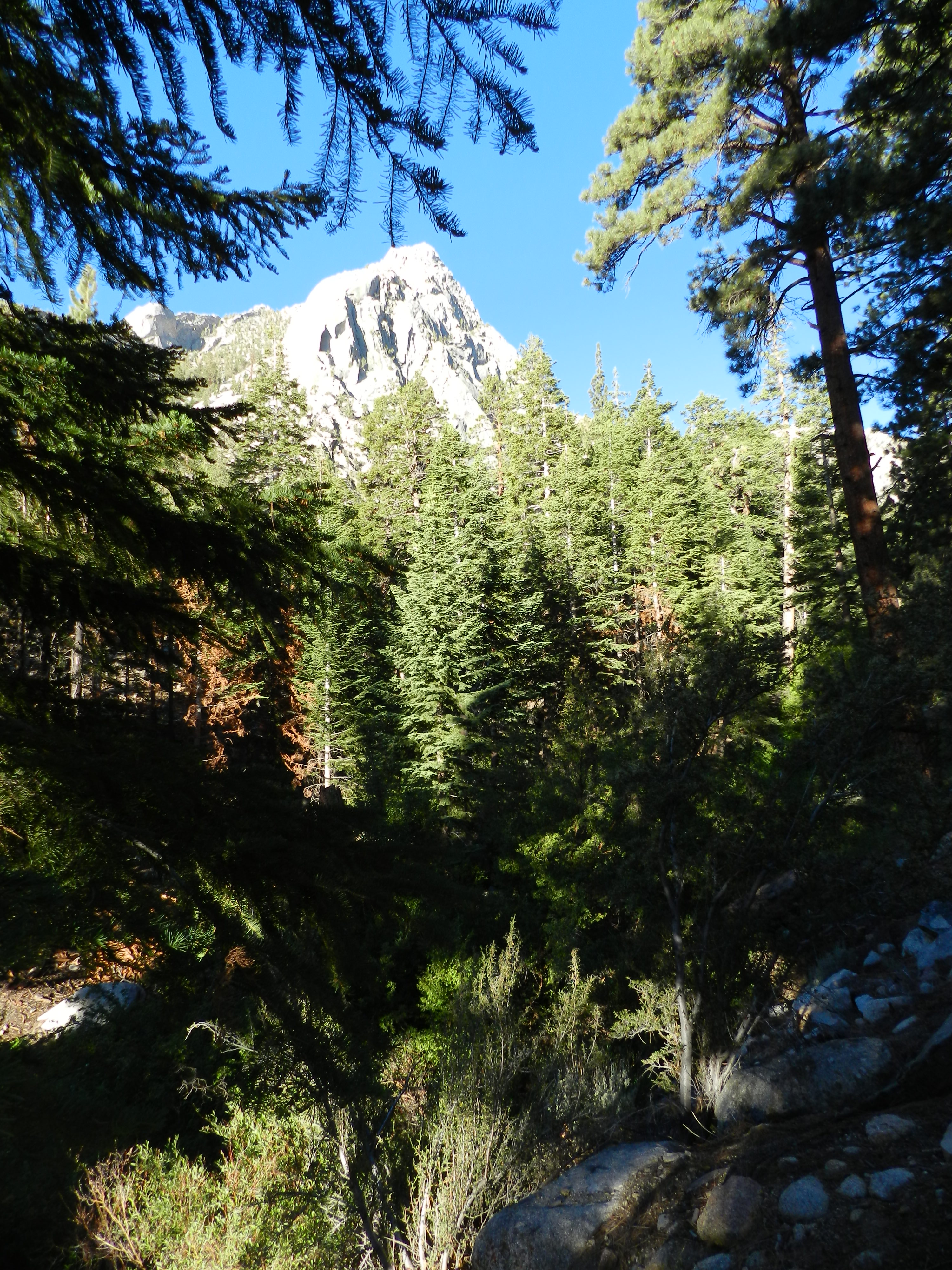
Mount Whitney sits in the Sierra Nevada – we drove up from San Diego. It’s a 5 hour jeep ride through forgotten California. I’m talking abandoned ghost towns and tumbleweeds. This is not the California you see on TV – there are no obscene displays of wealth here. Instead – out of this brown wasteland – the harsh, rugged granite mountains rise on the west and the cracked, sun-baked earth of Death Valley spans to the east. The 2,500 residents of Lone Pine live 60 minutes from both the highest and lowest elevations in the lower 48. This unparalleled terrain is the California in my heart. I will always miss it.
The Mt. Whitney Portal Campground is magical. Just when it seems like the desert will never end, the road turns into switchbacks and the smell of pine and forest takes over. Trees tower – lush and green – in stark contrast to the grey stone of the mountains behind them. The ground is cushioned by pine needles and you can hear the rush of a fast-flowing river from almost every camp site.

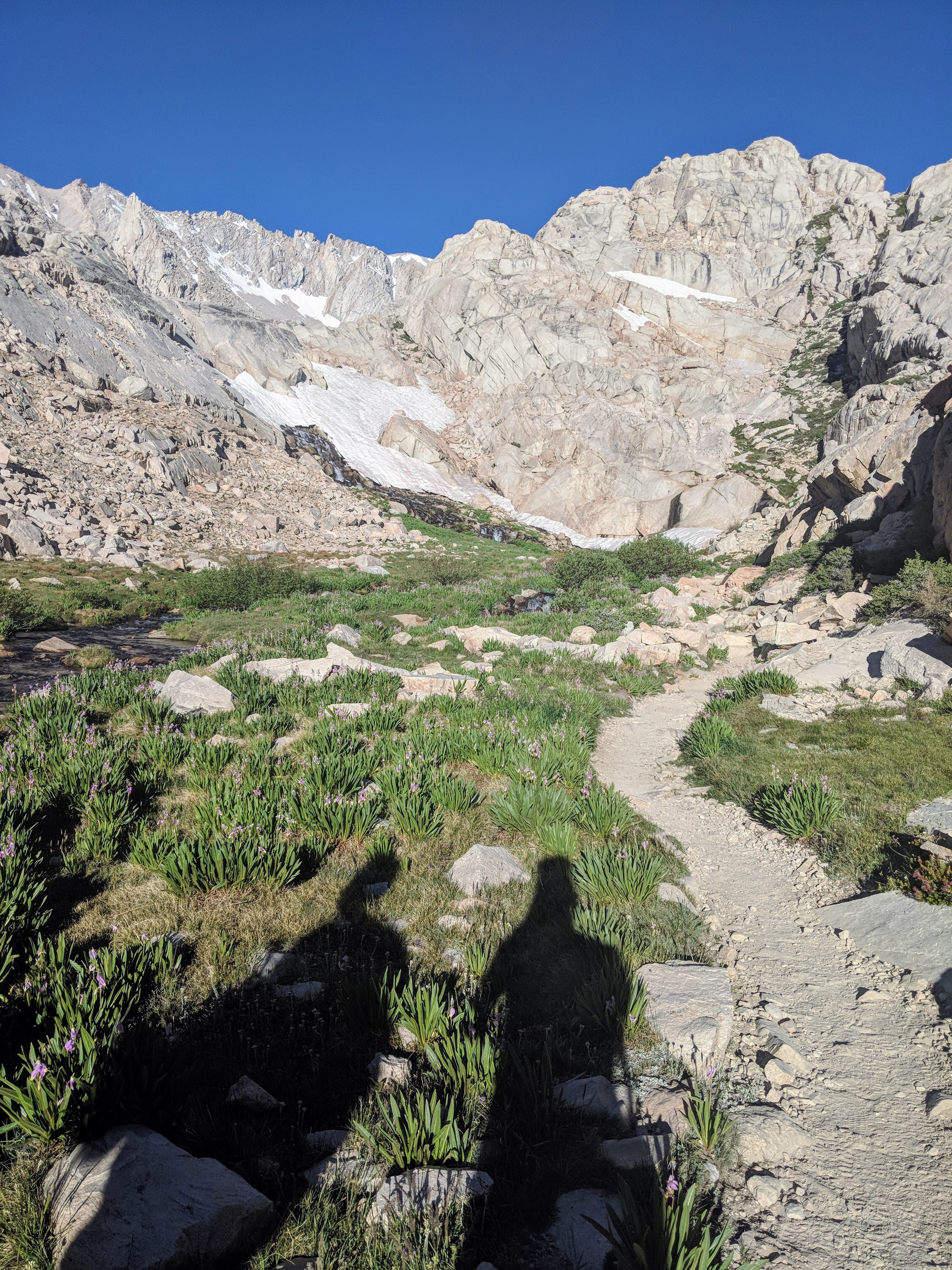
We woke up at 4:30 in the morning to drive to the trailhead. Headlamps secured, we started hiking a little after 5:00 a.m.
Fun Fact 2: The Whitney hike can be broken down into a few key checkpoints to help you guide your progress. There are some great websites out there that break the whole trail down. This isn’t one of them, but maybe you can glean some tidbits from my take on it:
- Whitney Portal. 0 miles in at 8,360 ft.
- Start early. 5 am is too late. Also, there are bathrooms here. Use them. Make sure you poop – Promise me you will poop.
- Lone Pine Lake. 2.5 miles in at 10,000 ft.
- You actually don’t need a permit to get here since it falls before the Whitney Zone. It is a beautiful spot for a picnic with sandy beaches along the lake itself. You will likely miss it if you start early enough since it will still be dark when you pass by.
- Outpost Camp and The Whitney Zone. 3.8 miles in at 10,400 ft.
- Camping option 1 for the lucky bastards with the overnight pass. Also a nice stretch of flat land after the initial steady incline.
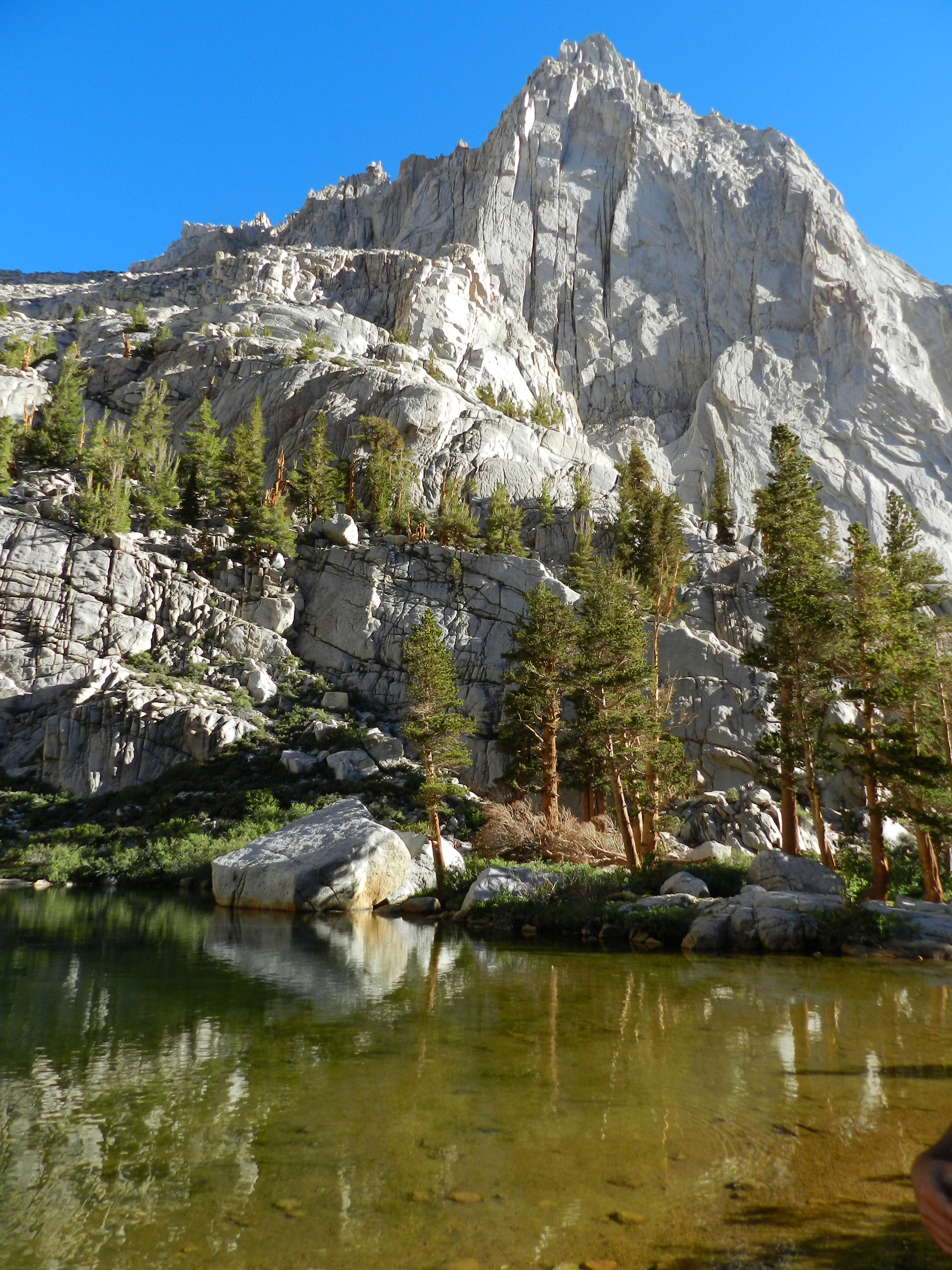
- Mirror Lake. 4 miles in at at 10,640 ft.
- If you have time, stop here for a moment. Surrounded in cold granite is the most serene green lake you will ever experience. Warm Beauty hiding within Stone Walls. Reflect on that.
- Trailside Meadows. 5 miles in at 11,359 ft.
- Marked by a stream gently rolling down the hill with bright yellow and pink flowers blooming along the sides. Also rocks everywhere on the trail. If you are going to roll an ankle, it will be in this region.
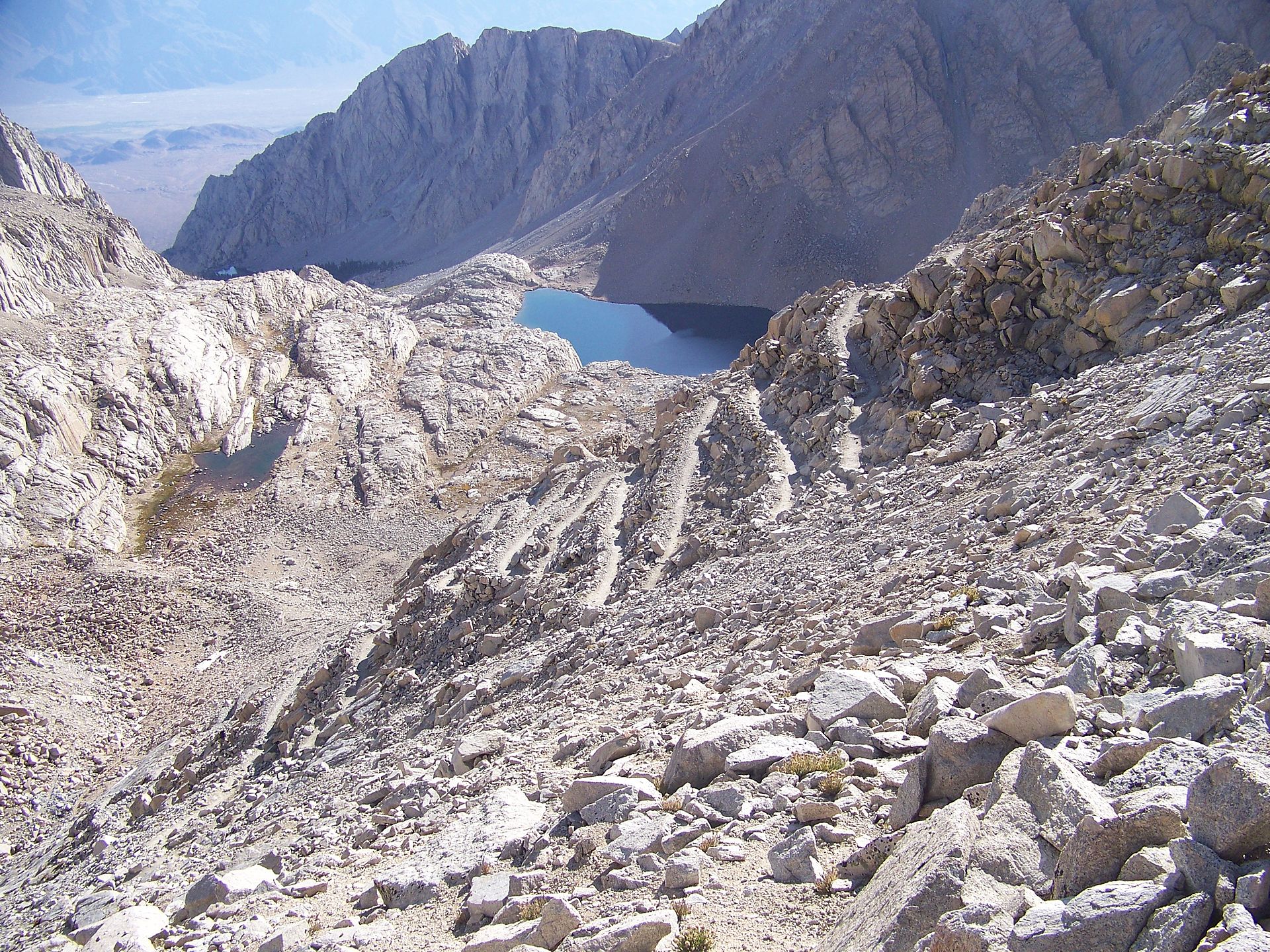
- Trail Camp. 6.3 miles in at 12,039 ft.
- More Rock. Everywhere. It is barren and windy. This is where most people with overnight passes stop and camp. Then they do a short day trip in the morning with a day pack. Us peons with the day-passes trudge along.
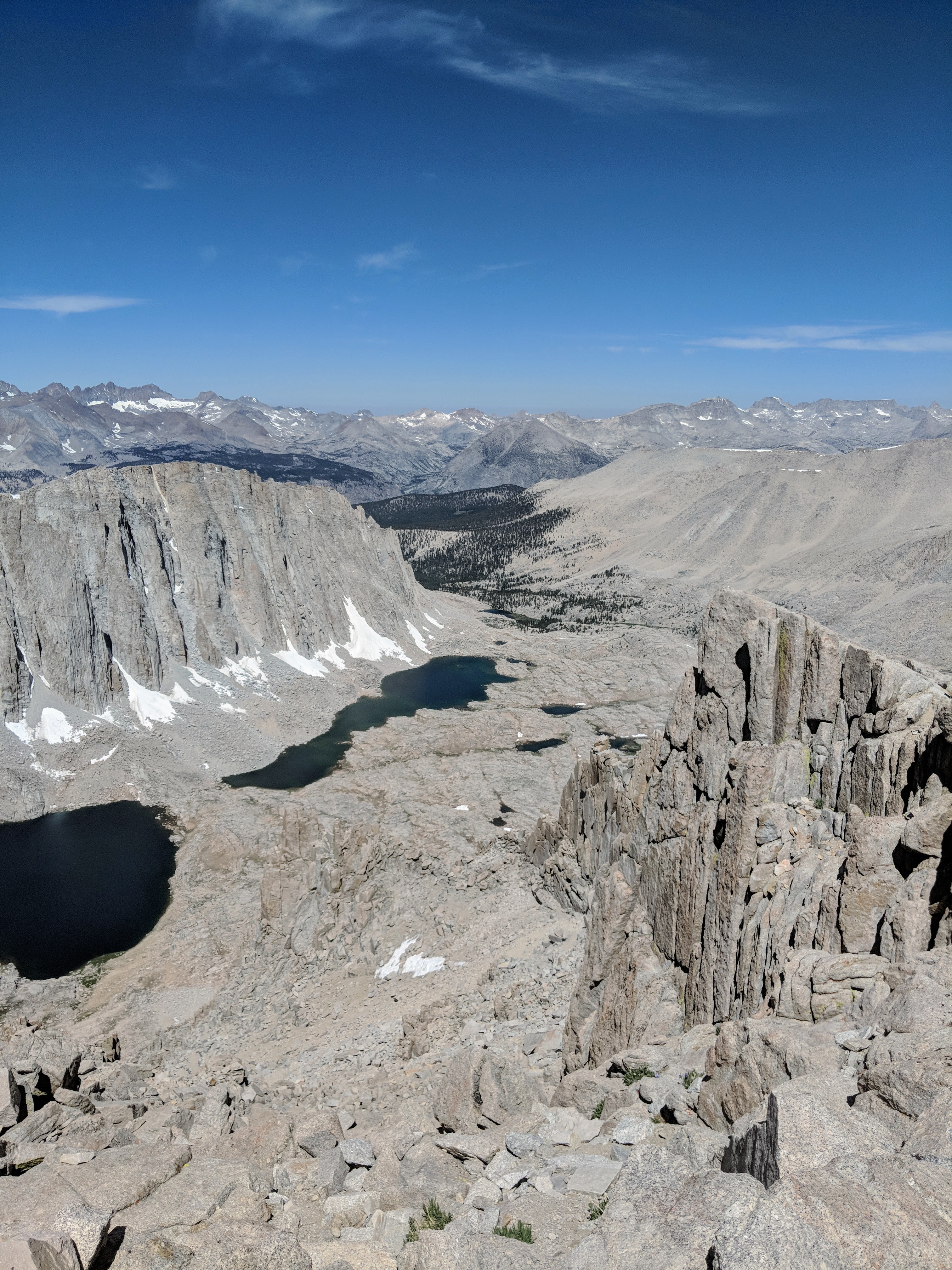
- Trail Crest. 8.5 miles in at 13,777 ft.
- Want to know how you gain almost 2,000 ft of elevation in 2 miles? 99 fucking switchbacks. That’s how. I got 99 problems and all of them are switchbacks.
- Trail Junction. 9 miles in at 13,480 ft.
- Why are we going down? Why are we on the backside of the mountain? Why is it so windy. Why can’t I see anything but rock? What was the point of climbing this mountain?
- Summit. 10.7 miles in at 14,505 ft.
- STEP. 1 – 2 – 3 – 4. STOP. BREATHE. REPEAT. Elevation exhaustion is a real thing, and even though it feels like every step empties you of all your air – keep walking. The stone house appears when you least expect it. And once you see it, you can suddenly breathe again. I promise.
Now here is the real kicker…
In 2013, I never made it to the summit. My brother was in far better shape than me and the Lt. He ended up separating from us somewhere around Trailside Meadow. Said he would wait at Trail Camp for us to catch up.
I said a small thank you prayer to the trail gods for letting me slow down. I was sluggish, but the Lt. was the one really struggling. Hard. He was nauseous and stopping for water so often that he eventually told me to keep going and just wait for him with Cornelius.
By the time I made it to Trail Camp my brother had already been waiting about 30 minutes. He needed to get moving again or there would be no way his legs would cooperate. I told him to continue and I’d wait for the Lt. We would either catch up at the summit or pass each other on the way down. I rested for 20 minutes and when there was still no sign of Lt. I started backtracking. I found him wandering a section just below the camp where the trail is hard to follow. He looked terrible and his sentences did not make sense. Incoherent. He had drank most of his water and still had a terrible headache. In true Lt. fashion he told me he would turn around but that I should keep going.
Not how marriages work sir. I wouldn’t leave him 6 miles from the trailhead in a delusional state of altitude sickness. I’d rather forgo the summit and finish this thing together – the same way we started. As we descended the mountain his coloring finally started to return. Since he was feeling better, we veered off on the way down to see Lone Pine lake. That is the only reason I know that there are sandy beaches there. NEVER write off the journey just because the destination changed. There is beauty and purpose in every experience.
Flash Forward. 5 Years 6 days later.
June 27th, 2018. I had finalized my 2nd divorce only 4ish months prior. My brother had secured another day pass for Whitney (honestly who the hell do you bribe for an overnight pass?). It was time to finish what I started.
52,114 Steps. 607 Floors. 20.96 Miles. At least that is what my FitBit collected before it died. Doesn’t matter though – stats or not – I made it to the top of that mountain. But the real hero was my brother. Cornelius stayed with me through it all.
When nerves kicked in on the snow covered narrow patch in the switchbacks – he led – leaving solid footprints that I could step on. When I was doubting my ability to take more than 2 steps at a time on the last half mile, he would keep us moving forward and remind me to breathe. When I was lost in the midst of my own personal turmoil for years dealing with the betrayal by Lt. and conflict with Batman, he was there. Waiting for me to resurface; waiting to remind me of how many more adventures there are to have – with or without someone by my side to experience them with.


The Descent:
This is the last piece that needs to be addressed. We are always so obsessed with the race to the top that virtually no one talks about the walk back down the damn mountain. In 2018 it took Cornelius and I about 15 hours to complete the hike – at least 6 of those were spent on the way down. I personally half-walked, half-ran down the last 2 miles. I was dealing with two options at the time: find a secluded spot to use my crap bag OR press on knowing that relief was waiting at the bottom. Not exactly a Sophie’s Choice type of moment but the pressure, literally, was real. But, I digress.
Hiking up, you don’t notice the blisters and sore muscles so much. You don’t notice your body swelling with the altitude…. or the constipation that has set in. It is slow and gradual. You are also rewarded with temporary spikes of adrenaline and endorphins each time you encounter a new section and again when you make it to the summit. It isn’t until you start making your way back down the mountain that you can feel again – the good and bad.

It made me uncomfortable to think about. How much have I done that in my day to day life? Focused so much energy on getting what I want that I ignored the warning signs my body or my emotions were giving me. You cannot charge up the mountain and expect to be acclimated at the top. If you want to enjoy and prolong your time at the top, you need to be mindful of pace. You must be patient and confident in the pace that works for you.
Whitney 2018 was a turning point for me in so many ways. Maybe because I was finally descending a separate emotional mountain as well. Either way I learned some lessons. Trust your values. Never compromise them in favor of a shortcut. Shift your focus from chasing your goals to living your truth. Accept – with an open heart – all the good that comes into your life and rest comfortably knowing that your goals will be within reach when you are ready.
